Monday, May 28, 2018

Journey to Trampas Lakes

On Memorial Day, we journeyed to the Trampas Lakes nestled between the Truchas Peaks of northern New Mexico. We rose early in the morning to begin the hike before the afternoon heat, hitting the trailhead just after 7am. The dawn rays were filtering down through the aspen trees and our morning climb was rather chilly as we hiked up 2,500 feet of elevation over 6 miles to reach the lakes.


Along the trail, we saw numerous wildflowers including purple asters, pink nodding onion, and fireweed. The trail closely followed a mountain stream, Rio de las Trampas (river of traps), cascading over mossy rocks creating small waterfalls into crystal-clear pools. The sound of the trickling water was meditative and the girls loved dipping their paws and lapping a fresh drink along the way. The scenery was magical. 


As we climbed higher, the aspen groves thinned and Ponderosa pine and conifer trees dominated the landscape. Just when we were beginning to tire from the relentless climb, the lakes revealed themselves. The two lakes are separated by a small hill with both lakes surrounded by towering mountain peaks including Sheepshead Peak and Truchas Peak. The lakes were calm and tranquil and we were alone at our destination. We quickly set up our backpacking hammock to enjoy the views and soak in our mountain time with our girls before heading back down the mountain. It was a gorgeous day!


-Lindsay


Saturday, January 20, 2018

A Balmy Day at Cerrillos Hills

Today we headed south on Highway 14 to the Cerrillos Hills State Park. Our humans had been here before, horseback riding with Broken Saddle, but this was the first trip for Roxie and me. We headed out after breakfast to beat the afternoon heat. I can't believe we are "beating the heat" in the middle of January, but Cerrillos, about 1,000 feet lower in elevation, is drier and warmer than Santa Fe.


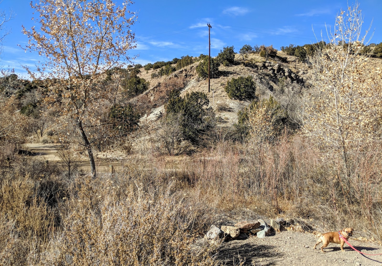
The landscape and terrain at Cerrillos Hills consist of dry desert rolling hills with sagebrush, pinon and juniper trees, as well as lots of cacti. We each got a few thorns in our paws, as careful as we were, but overall, I really enjoyed the soft dirt path. In some areas the path was just smooth, soft sand --I would try to sprint through, it felt so good on my paws!


We completed a five-mile loop around the park and I was surprised how much climbing we did over the hills. The vistas at each hilltop were stunning and offered 360-degree views of the Cerrillos Valley, Galisteo Basin, Sandia mountains in the distance, as well as Ortiz, Jemez, and the Sangre de Cristo mountains. Plus, in the 50-60 degree weather with only a slight breeze, the day felt much more like a late spring day than the middle of winter. It was a beautiful day to be outside and fully enjoy the views!


The hills of Cerrillos are the ancient skeletons of volcanoes that formed in this area over 30 million years ago. The rocks of the hills illustrate the dark basalt from lava flows as well as the lighter orange-red hues from where the lava mixed with water. It is here that miners would covet the deposits of silver, lead, and iron that led to the mining boom millions of years later. 


Along the trail, we viewed multiple mine openings and learned more about the mining industry that boomed in this area in the later 1800s. Most of the mines were for manganese, lead, and Galena, which is a lead sulfite or a mixture of lead and silver. Many of the abandoned mines have been filled in with earth over the years, but a few were so deep that we could not see the bottom!


Another surprise to us on the trail was a natural spring! With how dry the environment and the hills are, we were super shocked when we rounded a canyon bend and found flowing water. The slight hint of sulfur hit our noses, and lo and behold, a natural spring was bubbling up in the canyon. We could just barely hear the water flowing and gurgling along. The spring was lined with red willows and cottonwood trees, and I'm sure is very lush in the summertime. What an oasis in the desert!


Towards the end of the hike, I begin to peter out. The heat of the day mixed with the dry dust of the trail tired me out and my humans carried me the last mile of the trail. Ok, maybe I'm a little too spoiled, but there's nothing like still enjoying the views, fresh air, and warm sunshine while being carried by my humans!


What a beautiful day for exploring!

-Rosie


Monday, January 1, 2018

A New Year --But Where's the Snow?

Happy New Year, Furiends! We hope everyone had a wonderful holiday season and got to soak in plenty of family time, great food, and the holiday spirit! Now, onwards to the new year, new journeys, and new adventures!


For our new year's hike, we decided to hike our old faithful, Atalaya Mountain, to work off our holiday indulgences. New Mexico is currently experiencing unusually dry and warm weather (send some snow our way!), so we were all able to hike up the mountain without jackets! Too weird!


Maybe because our trail was so dry, I noticed a number of rock stacks, also known as Cairns, along the path that I hadn't noticed before. Cairns, derived from a Scottish Gaelic word, have been used from prehistorical times to modern day as a means to mark specific landmarks or sites. These sites could include anything from burial monuments, hunting and defense sites, to astrological points or for ceremonial purposes. Today, many of the cairns you see along trails are used as trail-markers where the trail can easily be lost. Perhaps these Cairns were recently built in anticipation of the next snowstorm we are all desperately wishing for here in northern New Mexico. Nonetheless, I think they add a nice touch to the trails, perfectly balanced and formed, and remind me to recognize that there was once a time when people would have used Cairns as a form of communication and survival.


When we finally made it to the top, we were able to enjoy the mountaintop views and have a splendid rest in the balmy weather. There have been many times in the past in which it was too cold and windy to really enjoy the views, so today we soaked up the sunshine and basked in the gorgeous views of the Santa Fe Valley, that even though are entirely lacking in snow, are still beautiful nonetheless.


Praying for snow, 
Roxie

Friday, November 24, 2017

#OptOutside Friday at the Shuree Ponds

For #OptOutside Friday this year, we celebrated the beautiful state we live in by driving north to the Valle Vidal lush mountain basin located in the heart of the Sangre de Cristo mountains. The Valle Vidal is a Rocky Mountain paradise with vast alpine meadows that provide a vital habitat for New Mexico's largest herds of elk. My human saw an elk when he first arrived but scared him away before the rest of us got a peek. Boo! He didn't even get a picture!


After a long but beautiful drive down a not-so-good dirt road (typical of northern New Mexico), we arrived at our destination, the Shuree Ponds. The ponds are the perfect place to enjoy the beautiful surrounding scenery and a picnic lunch. You can see the surrounding mountain ranges and ridges of the Rock Wall from the valley.


The water was crystal clear, reflecting the great blue sky above. We enjoyed the afternoon walking around the ponds, enjoying a wonderful picnic lunch full of Thanksgiving leftovers, and the great outdoors with my family. This sure beats the lines, crowds, and consumerism of Black Friday!


I don't know about you, but #OptOutside Friday is my new favorite holiday!

-Rosie